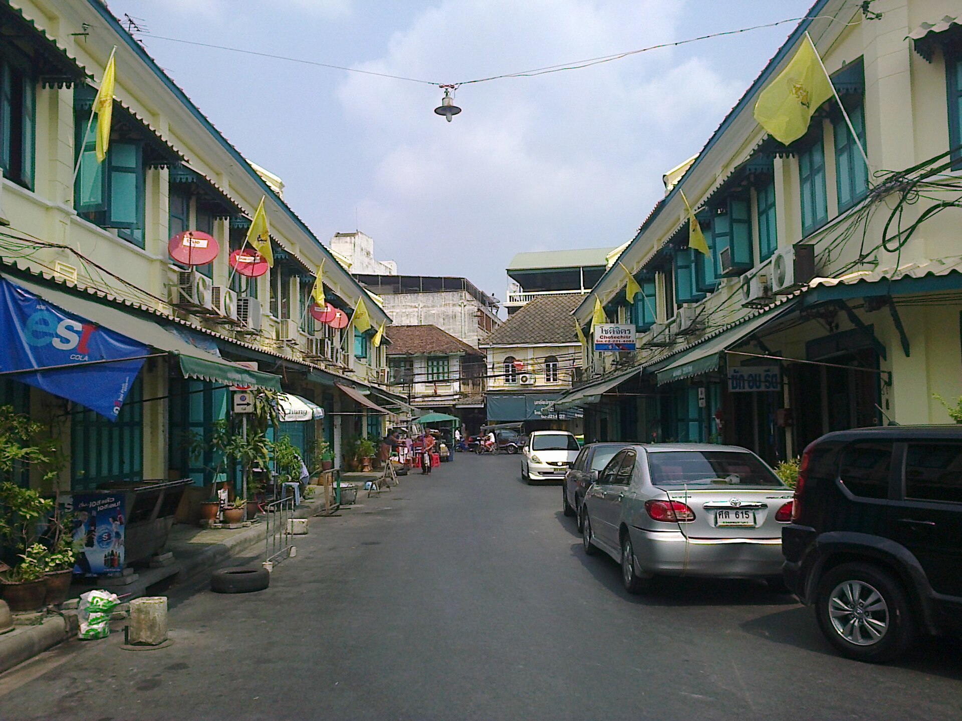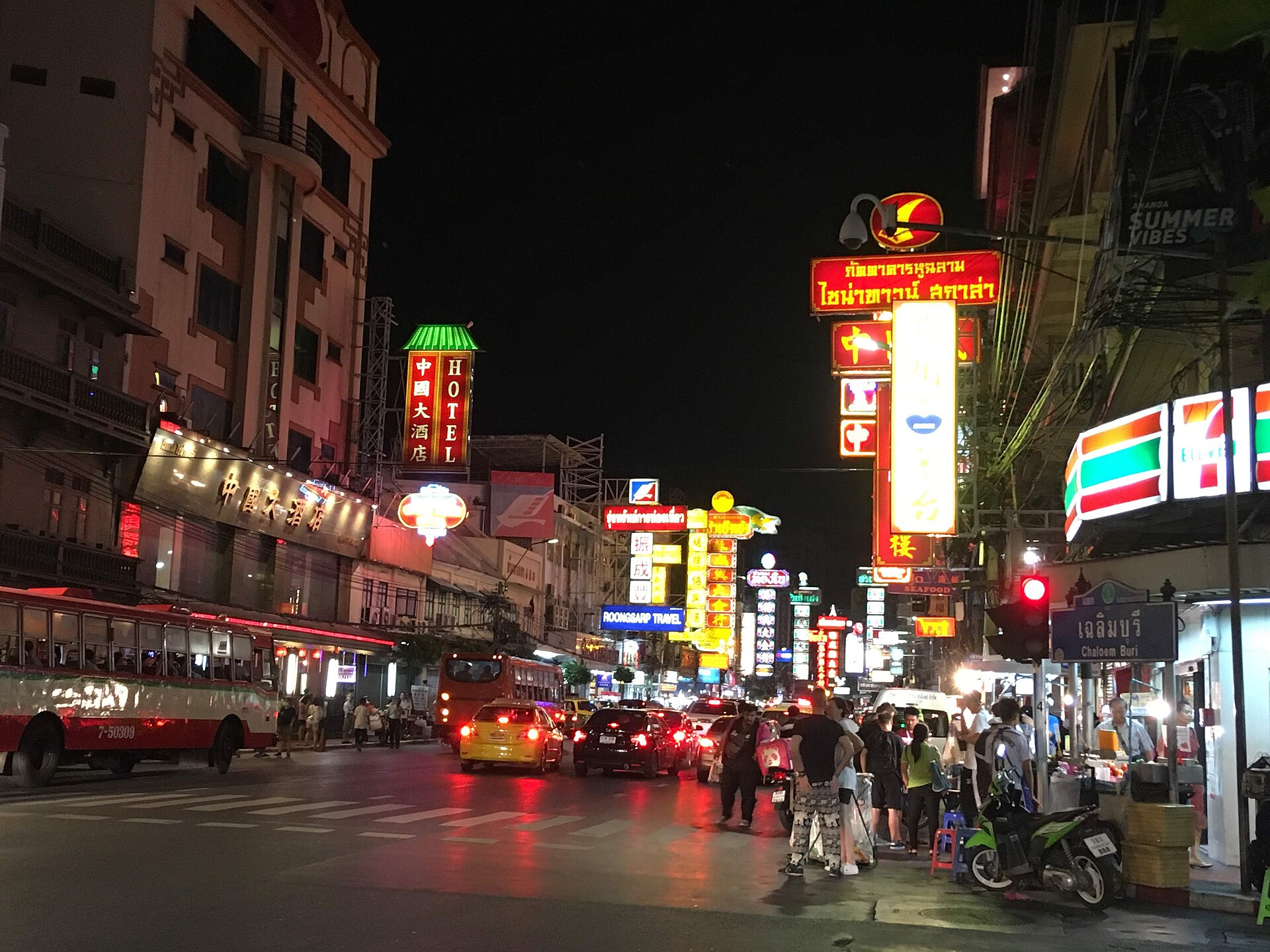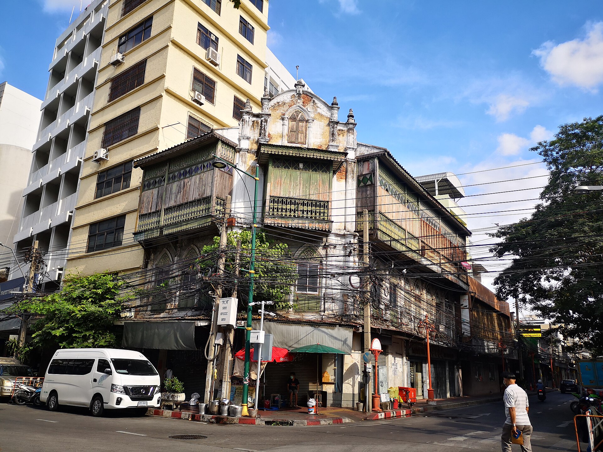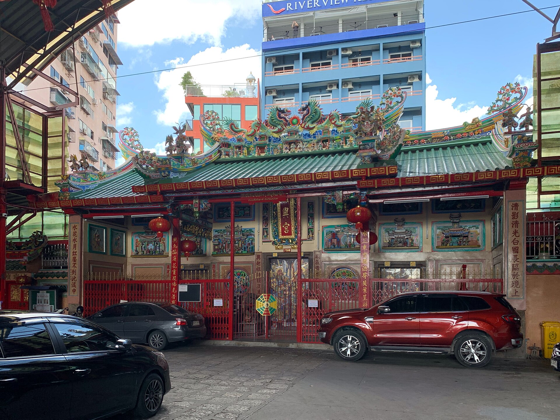
BKKxC(ulture)

Field atlas 01 · Bangkok urban fabric

Bangkok is a city of rows.

กรุงเทพฯ คือเมืองแห่งตึกแถว

Palaces draw the skyline. Rowhouses make the city. This directory follows the continuous fabric—from royal-frontage blocks and Chinatown trade streets to Thonburi markets and an eastern canal settlement—without confusing a curated corridor with a legal boundary.

29mapped corridors
26/46ONEP records located
870+published units
2,311footprints to review

How to read the map

Evidence, not aesthetic guesswork.

Fine Arts register links to a published monument record or conservation award.

Published count uses a scholarly or institutional inventory, including unit numbers where reported.

Curated corridor locates a documented community or street, but does not claim cadastral precision.

Map geometry uses solid lines for high-confidence axes and dashed lines for interpretive connections.

Arrive by public transport

Old Bangkok without a car.

The old city is not one destination; it is a chain of river, canal and rail gateways. Use the map to understand the network, then walk the last few blocks slowly. Boat routes are dotted; rail lines are solid. Every service links to its operator because Bangkok moves.

MRT Blue

MRT Blue Line · Old Town arc

รถไฟฟ้ามหานคร สายสีน้ำเงิน · ช่วงเมืองเก่า

Daily 06:00–24:00. This map shows the five-station heritage arc; trains continue around the full Blue Line.

Official service information ↗

Express Boat

Chao Phraya Express · heritage reach

เรือด่วนเจ้าพระยา · ช่วงย่านมรดก

Weekday flag services connect Bangkok's river districts. Stops differ by flag, so check the operator timetable before travelling.

Official service information ↗

Tourist Boat

Chao Phraya Tourist Boat

เรือท่องเที่ยวเจ้าพระยา

A visitor-oriented river service linking 11 piers, normally every 30 minutes. The evening extension reaches Asiatique.

Official service information ↗

Saen Saep

Khlong Saen Saep Boat · western reach

เรือคลองแสนแสบ · ช่วงตะวันตก

The western route terminates beside Golden Mount at Phan Fa Lilat and continues east through Pratunam by interchange.

Official service information ↗
Read the map honestly. Routes are schematic orientation lines, not live vehicle positions. Service patterns and pier calls can change; check the linked operator before travel.Open the transport map ↗

Official coverage spine · 46 records

A source register with its gaps left visible.

The official Rattanakosin survey's category E is the closest thing Bangkok has to a rowhouse-fabric baseline. It contains 41 rowhouse ensembles, four standalone commercial buildings and one related structure—not 46 interchangeable rows.

Open the 388-page ONEP survey ↗
26records linked to a mapped corridor
20records still in the mapping queue
41 + 4 + 1ensembles · buildings · related structure
Inner Rattanakosin8/12 located
1E1-057
Phraeng Phuthon rowsตึกแถวสองฟากถนนแพร่งภูธร
rowhouse ensembleP3 · 14/15
1E1-058
Giant Swing and curved Bamrung Mueang rowsตึกแถวบริเวณลานเสาชิงช้าโค้งถนนบำรุงเมือง
rowhouse ensembleP3 · 14/15
1E1-059
Tanao Road rows, section 1ตึกแถวริมถนนตะนาว (ช่วงที่ 1)
rowhouse ensembleP3 · 14/15
1E1-060
Maha Rat Road rows at Tha Chang Wang Luangตึกแถวริมถนนมหาราช บริเวณท่าช้างวังหลวง
rowhouse ensembleP3 · 14/15
1E1-061
Tha Tien rowsตึกแถวบริเวณท่าเตียน
rowhouse ensembleP3 · 14/15
1E1-062
Phraeng Nara, Asdang and Tanao rows with Talaphat Suksa Schoolตึกแถวสองฟากถนนแพร่งนรา ตึกแถวบางส่วนของถนนอัษฎางค์ ตึกแถวบางส่วนของถนนตะนาว และอาคารโรงเรียนตะละภัฏศึกษา
rowhouse ensembleP3 · 14/15
1E1-063
Na Phra Lan rowsตึกแถวริมถนนหน้าพระลาน
rowhouse ensembleP3 · 13/15
1E5-064
S.E.C. Buildingตึก S.E.C.
commercial buildingP4 · 12/15
Mapping queue
1E1-065
Asdang, Phra Phitak and Ban Mo rowsตึกแถวบางส่วนริมถนนอัษฎางค์ ตึกแถวบางส่วนริมถนนพระพิทักษ์ และตึกแถวบางส่วนริมถนนบ้านหม้อ
rowhouse ensembleP3 · 14/15
1E5-066
S.A.B. Buildingตึก S.A.B.
commercial buildingP4 · 12/15
Mapping queue
1E6-067
Tang Toh Kang gold shopห้างทองตั้งโต๊ะกัง
commercial buildingP4 · 12/15
Mapping queue
1E6-068
Bangkok Bank, Sampheng branchธนาคารกรุงเทพ สาขาสำเพ็ง
commercial buildingP4 · 10/15
Mapping queue
Intermediate conservation area15/22 located
2E1-066
Bowonniwet Temple rowsตึกแถวข้างวัดบวรนิเวศวิหาร
rowhouse ensembleP3 · 13/15
2E1-067
Tanao Road rows, sections 2 and 3ตึกแถวริมถนนตะนาวช่วงที่ 2 และช่วงที่ 3
rowhouse ensembleP3 · 13/15
2E1-068
Bamrung Mueang rows, Saphan Chang Rong Si to Maha Chaiตึกแถวถนนบำรุงเมือง (จากแยกสะพานช้างโรงสีถึงแยกมหาไชย)
rowhouse ensembleP3 · 13/15
2E1-069
Single-storey Dinso–Phra Sumen rowsตึกแถวชั้นเดียวริมถนนดินสอ–ถนนพระสุเมรุ
rowhouse ensembleP4 · 12/15
2E5-070
Borom Banphot alley rowsตึกแถวในซอยบรมบรรพต
rowhouse ensembleP4 · 12/15
Mapping queue
2E1-071
Fueang Nakhon Road rowsตึกแถวริมถนนเฟื่องนคร
rowhouse ensembleP4 · 12/15
Mapping queue
2E1-072
Phra Athit–Phra Sumen rowsตึกแถวริมถนนพระอาทิตย์–ถนนพระสุเมรุ
rowhouse ensembleP4 · 11/15
2E1-073
Tani Road rows and Woraphot Buildingตึกแถวริมถนนตานีและอาคารวรพรต
rowhouse ensembleP4 · 11/15
2E1-074
Single-storey rows at Sukha 1/2, Fueang Nakhonตึกแถวชั้นเดียวในซอยสุขา 1 และสุขา 2 ถนนเฟื่องนคร
rowhouse ensembleP4 · 11/15
Mapping queue
2E1-075
Srasong–Longtha rows behind Wat Suthatตึกแถวบริเวณด้านหลังวัดสุทัศนเทพวราราม–คลองหลอดวัดราชบพิธ
rowhouse ensembleP4 · 11/15
2E1-076
Phraya Si Road rowsตึกแถวริมถนนพระยาศรี
rowhouse ensembleP4 · 11/15
2E1-077
Chak Phet rows at Memorial Bridgeตึกแถวเชิงสะพานพระพุทธยอดฟ้า ริมถนนจักรเพชร
rowhouse ensembleP4 · 10/15
2E1-078
Phra Nakhon bridgehead rows at Memorial Bridgeตึกแถวเชิงสะพานพระพุทธยอดฟ้า ฝั่งพระนคร
rowhouse ensembleP4 · 10/15
2E1-079
Ban Phan Thom alley and Phra Sumen rowsตึกแถวในซอยบ้านพานถม ถนนพระสุเมรุ
rowhouse ensembleP4 · 10/15
2E5-080
Charoen Krung Road rowsตึกแถวริมถนนเจริญกรุง
rowhouse ensembleP4 · 10/15
2E6-081
Yaowarat Road rowsตึกแถวริมถนนเยาวราช
rowhouse ensembleP4 · 12/15
2E6-082
Wanit 1 / Sampheng rowsตึกแถวถนนวานิช 1 (สำเพ็งหรือสามเพ็ง)
rowhouse ensembleP4 · 12/15
2E6-083
Song Wat Road rowsตึกแถวริมถนนทรงวาด
rowhouse ensembleP4 · 11/15
2E6-084
Chakkrawat Road rowsตึกแถวบริเวณจักรวรรดิ
rowhouse ensembleP4 · 10/15
Mapping queue
2E5-085
Worachak Road rowsตึกแถวริมถนนวรจักร
rowhouse ensembleP4 · 10/15
Mapping queue
2E6-086
Anuwong Road rowsตึกแถวถนนอนุวงศ์
rowhouse ensembleP4 · 10/15
Mapping queue
2E6-087
Ratchawong Pier rowsตึกแถวบริเวณท่าน้ำราชวงศ์
rowhouse ensembleP4 · 10/15
Mapping queue
Outer Rattanakosin3/12 located
3E1-036
Ban Mo Road rowsตึกแถวถนนบ้านหม้อ
rowhouse ensembleP4 · 11/15
3E5-037
Nakhon Sawan Road rowsตึกแถวถนนนครสวรรค์
rowhouse ensembleP4 · 10/15
Mapping queue
3E1-038
Si Kak Phraya Si rowsตึกแถว สี่กั๊กพระยาศรี
rowhouse ensembleP4 · 10/15
3E5-039
Boriphat Road rowsตึกแถวถนนบริพัตร
rowhouse ensembleP4 · 10/15
Mapping queue
3E5-040
Rows behind Wat Saketตึกแถวหลังวัดสระเกศ
rowhouse ensembleP5 · 8/15
Mapping queue
3E1-041
Samsen Road rowsตึกแถวถนนสามเสน
rowhouse ensembleP5 · 7/15
Mapping queue
3E2-042
Santa Cruz church pier pavilionศาลาท่าน้ำ วัดซางตาครู้ส
related structureP5 · 7/15
Mapping queue
3E6-043
Woeng Nakhon Kasem rowsตึกแถวเวิ้งนาครเขษม
rowhouse ensembleP4 · 10/15
Mapping queue
3E5-044
Suan Mali rowsตึกแถวสวนมะลิ
rowhouse ensembleP5 · 8/15
Mapping queue
3E5-045
Maitri Chit Road rowsตึกแถวถนนไมตรีจิตต์
rowhouse ensembleP5 · 6/15
Mapping queue
3E4-046
Prok Arun rowsตึกแถวปรกอรุณ
rowhouse ensembleP5 · 5/15
Mapping queue
3E6-047
Luenrit rowsเวิ้งเลื่อนฤทธิ์
rowhouse ensembleP4 · 11/15

“Located” means this atlas has linked the official record to a sourced explorer corridor. It does not mean a cadastral footprint, present condition or legal protection has been verified.

Machine review queue · Overture 2026-07-22.0

2,311 shapes worth looking at—not 2,311 heritage claims.

We screened present-day Overture building roofprints and footprints near the 29 sourced corridors. The result is a transparent fieldwork queue: turn it on in the 3D map, click a building, and see why it surfaced.

1,001strong morphology
1,310possible morphology
14,421historic survey units used only to calibrate shape
Hard boundary: Machine-screened present-day building roofprints/footprints near documented cultural corridors. These polygons are not confirmed rowhouses, age estimates, cadastral parcels, statutory conservation zones or heritage designations. Field and archival verification are required.

Method calibration: 1988 Bangkok shophouse composition study ↗ · Geometry: Overture Maps buildings guide ↗ · Full reproducible method ↗
01
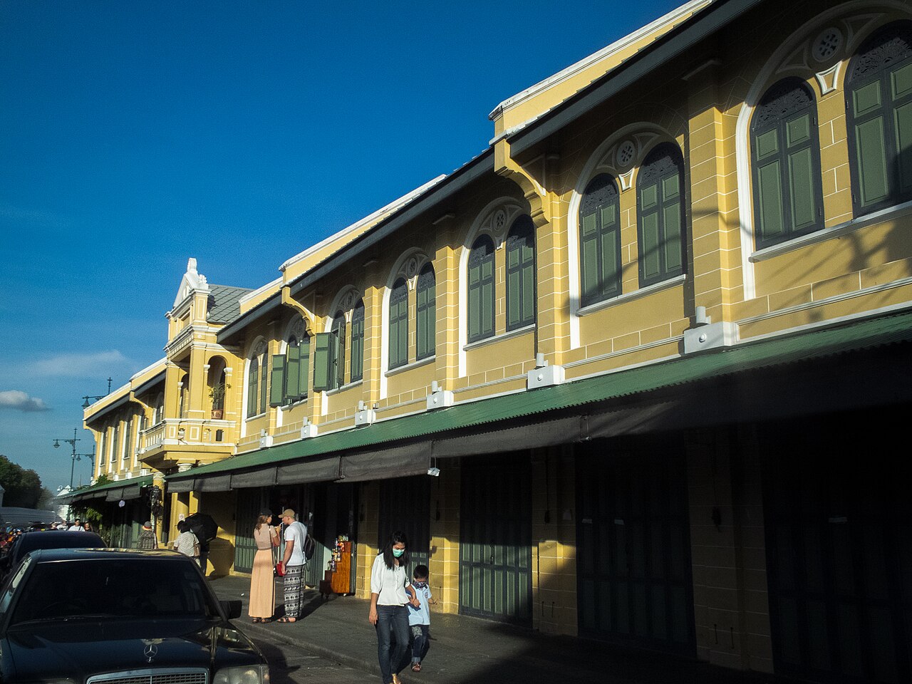
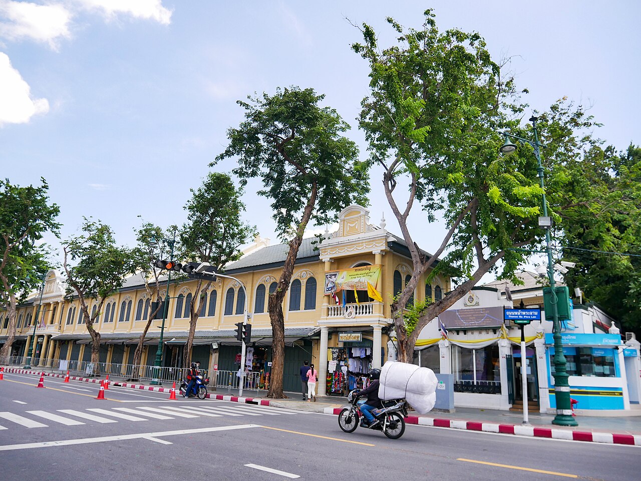
Na Phra Lan shophouses
กสิณธร ราชโอรส · Wikimedia Commons · CC BY-SA 4.0
Royal frontageEarly 20th century

Na Phra Lan shophouses

ตึกแถวหน้าพระลาน

Conservation without an empty museum street

The Grand Palace is the postcard. This disciplined, tenant-occupied edge is the city-making architecture. Its restoration kept the people and repaired the whole façade as one civic room.

Typology
Continuous two-storey royal-frontage row
Evidence
Fine Arts register
Register / award
UNESCO Asia-Pacific Award 2011
ONEP survey
1E1-063
Nearest public transport
Tha Chang · 194 m / Tha Maharaj · 329 m
Shapes to review
30 unverified candidates
Map geometry
OSM street axis · high confidence

Explorer noteWalk the opposite pavement at opening time; the repeated bays read best before tour traffic fills the curb.

02
Tha Tien market blocks
I3LACK1CE · Wikimedia Commons · CC BY-SA 4.0
Market rowLate 19th century onward

Tha Tien market blocks

กลุ่มตึกแถวท่าเตียน

490 units—urban heritage at district scale

Not one building: 490 shop units, a market and a river landing working as a single urban instrument. The smell, wholesale trade and ferry rhythm are part of the heritage—not noise around it.

Typology
Market-and-pier shophouse ensemble
Evidence
Published count
Published count
490 units
ONEP survey
1E1-061
Nearest public transport
Tha Tien · 79 m / Wat Arun Pier · 222 m
Shapes to review
5 unverified candidates
Map geometry
documented block extent · high confidence

Explorer noteEnter from Maha Rat, cross the market, then look back from the Wat Arun ferry queue.
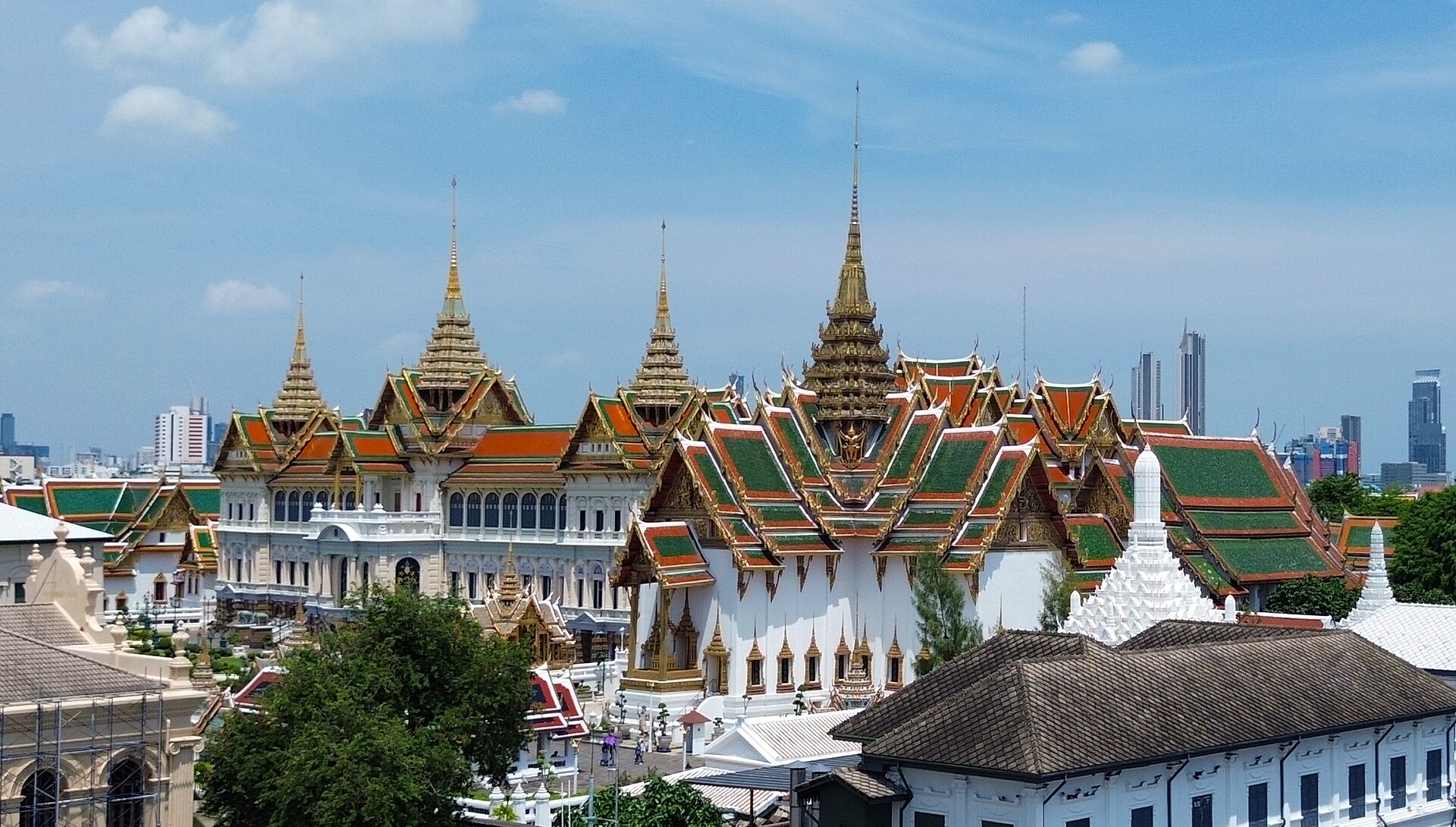
03
Tha Chang–Maha Rat frontage
Don Ramey Logan · Wikimedia Commons · CC BY 4.0
Royal frontageRama V–VI era

Tha Chang–Maha Rat frontage

ตึกแถวท่าช้าง–ถนนมหาราช

Palace edge, public life

A working seam between palace wall, university, amulet trade and river pier. Heritage here is measured by how many different Bangkok lives can still share one short frontage.

Typology
Pier-facing masonry row
Evidence
Fine Arts register
Register / award
FAD-68
ONEP survey
1E1-060
Nearest public transport
Tha Chang · 50 m / Tha Maharaj · 282 m
Shapes to review
9 unverified candidates
Map geometry
OSM street axis · high confidence

Explorer noteTake the cross-river boat once. The row is easier to understand from the water than from the pavement.

04
Sam Phraeng
Kasom SKULTAB · Wikimedia Commons · CC BY-SA 3.0
Market rowLate 19th–early 20th century

Sam Phraeng

สามแพร่ง

119 units grown from three palaces

Three former palace compounds became 119 commercial units and a rare interior square. Bangkok did not copy a colonial port here; it converted royal land into a compact mercantile neighbourhood.

Typology
Three palace-land shophouse enclaves
Evidence
Published count
Published count
119 units
ONEP survey
1E1-057 · 1E1-062
Nearest public transport
Sam Yot · 539 m / Phan Fa Lilat · 888 m
Shapes to review
180 unverified candidates
Map geometry
documented block extent · high confidence

Explorer noteStart at Phraeng Phuthon before breakfast, then cut through Phraeng Nara rather than circling the arterial roads.
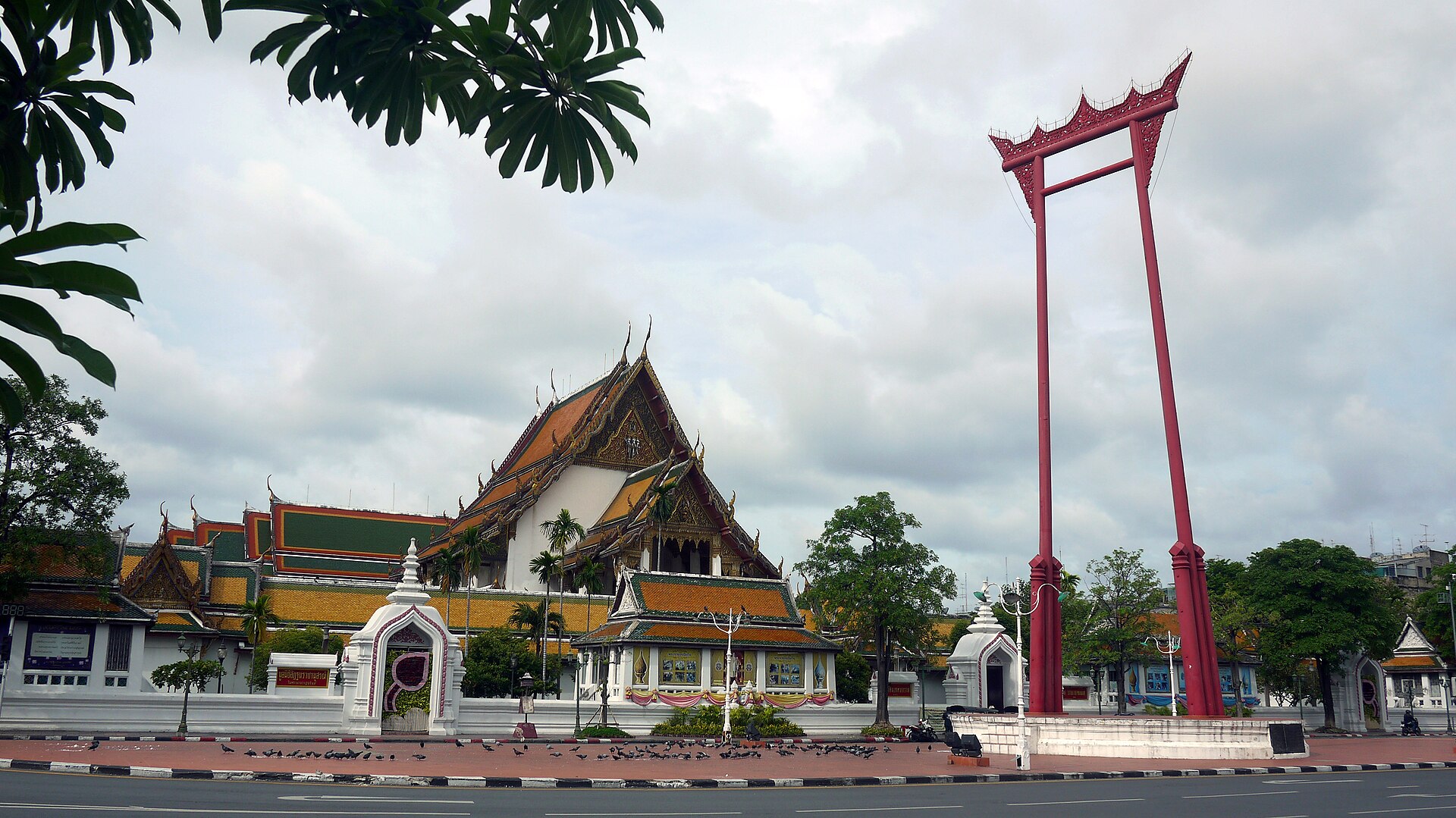
05
Bamrung Mueang–Giant Swing rows
Chusak Vijakkhana - Chusak50 · Wikimedia Commons · CC BY-SA 3.0
Commercial streetRama V era

Bamrung Mueang–Giant Swing rows

ตึกแถวบำรุงเมือง–เสาชิงช้า

A street wall that makes the monument

The curve does the work. These rows turn the Giant Swing from an object into a place, holding the street wall while temple, city hall and specialist shops face one another.

Typology
Civic-axis corner and curved masonry rows
Evidence
Fine Arts register
Register / award
FAD-5604 / FAD-5386
ONEP survey
1E1-058 · 2E1-068
Nearest public transport
Sam Yot · 521 m / Sanam Chai · 867 m
Shapes to review
38 unverified candidates
Map geometry
OSM street axis · high confidence

Explorer noteLook above the signs. The useful evidence is in parapets, bay widths and the corner turn.
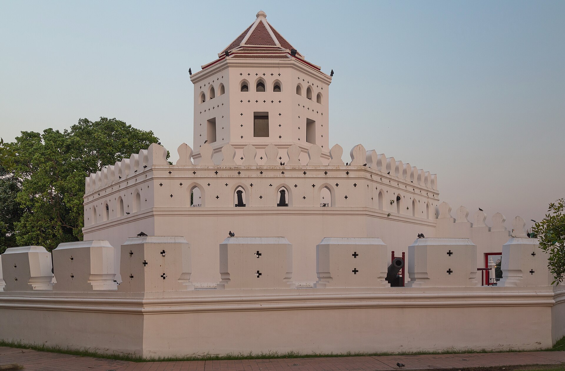
06
Bowonniwet Temple rows
Marcin Konsek · Wikimedia Commons · CC BY-SA 4.0
Royal frontage1851–1868; later Rama V layers

Bowonniwet Temple rows

ตึกแถวหน้าวัดบวรนิเวศวิหาร

The oldest surviving row is still an ordinary street

Bangkok's oldest surviving Rattanakosin rowhouse group began as dwellings for Grand Palace officers, then learned to trade without losing its long civic edge. The corner rises, the ordinary bays repeat, and the temple street becomes a room rather than leftover traffic space.

Typology
L-shaped one- and two-storey temple-frontage row
Evidence
Published count
Published count
46 units
ONEP survey
2E1-066 · 2E1-069
Nearest public transport
Phra Arthit · 696 m / Phan Fa Lilat · 706 m
Shapes to review
67 unverified candidates
Map geometry
documented block extent · high confidence

Explorer noteBegin on Phra Sumen Road, turn the corner into Dinso, and watch how the row changes height without breaking its street wall.

07
Tanao Road rows
Kasom SKULTAB · Wikimedia Commons · CC BY-SA 3.0
Commercial streetRama V era

Tanao Road rows

ตึกแถวริมถนนตะนาว

One street stitches several old towns together

Tanao is the quiet north–south stitch of the old city. Its plain early rows do not compete with monuments; they connect Bowonniwet, Khok Wua, Sam Phraeng and the Giant Swing into one walkable sequence of trade, dwelling and worship.

Typology
Long two-storey masonry street rows in three survey sections
Evidence
Fine Arts register
ONEP survey
1E1-059 · 2E1-067
Nearest public transport
Phan Fa Lilat · 647 m / Phra Arthit · 859 m
Shapes to review
312 unverified candidates
Map geometry
OSM street axis · high confidence

Explorer noteWalk south from the Bowonniwet corner and keep to one pavement; the changing shop signs reveal how much of the repeated upper façade survives.

08
Tani Road rows
Marcin Konsek · Wikimedia Commons · CC BY-SA 4.0
Commercial streetRama V–VI era

Tani Road rows

ตึกแถวถนนตานีและอาคารวรพจน์

Read behind the backpacker street

Tani is easy to dismiss as Khao San's service edge. The official survey asks us to read it differently: as a surviving rowhouse street anchored by Woraphot Building, where small rooms, food and travel have shared a compact frontage for generations.

Typology
Short east–west lodging and market row
Evidence
Fine Arts register
ONEP survey
2E1-073
Nearest public transport
Phra Arthit · 463 m / Phan Fa Lilat · 917 m
Shapes to review
36 unverified candidates
Map geometry
OSM street axis · high confidence

Explorer noteArrive before the evening crowd and compare the upper floors at both ends; this is a working street, not an isolated façade.

09
Ban Phan Thom rows
Marcin Konsek · Wikimedia Commons · CC BY-SA 4.0
Community conservationRama V era onward

Ban Phan Thom rows

ตึกแถวบ้านพานถม–ถนนพระสุเมรุ

The craft quarter begins where the avenue narrows

The official record catches the seam between a neighbourhood named for beaten-metal craft and the larger Phra Sumen road. Heritage here is not a decorative strip: it is the small lane, shop depth and domestic life that let a specialised community meet the city.

Typology
Alley-and-arterial rows at a craft-community edge
Evidence
Fine Arts register
ONEP survey
2E1-079
Nearest public transport
Phan Fa Lilat · 734 m / Thewet · 825 m
Shapes to review
49 unverified candidates
Map geometry
documented block extent · medium confidence

Explorer noteTurn off Phra Sumen into the smaller lanes; the cultural evidence sits in the change of scale, not in a single landmark.

10
Phra Athit Khao Hong row
Marcin Konsek · Wikimedia Commons · CC BY-SA 4.0
Royal frontageEarly 20th century

Phra Athit Khao Hong row

ตึกแถวเก้าห้อง ถนนพระอาทิตย์

Nine bays, one complete civic edge

Only nine bays, but a complete urban sentence: fort, river road, shade trees, homes above trade. Small ensembles like this are where citywide databases usually fail.

Typology
Nine-bay river-road shophouse row
Evidence
Published count
Published count
9 units
ONEP survey
2E1-072
Nearest public transport
Phra Arthit · 81 m / Tha Maharaj · 997 m
Shapes to review
22 unverified candidates
Map geometry
documented block extent · high confidence

Explorer notePair it with the fort at dusk, then use the river path—not Khao San—as your exit.

11
Luenrit community
Christophe95 · Wikimedia Commons · CC BY-SA 4.0
Community conservationEarly 20th century

Luenrit community

ชุมชนเลื่อนฤทธิ์

The tenants saved the block

Tenants stopped demolition, organised, financed and reopened the restored block in 2022. This is Bangkok's strongest answer to the idea that conservation must arrive from outside the community.

Typology
Neoclassical Chinatown shophouse block
Evidence
Published count
ONEP survey
3E6-047
Nearest public transport
Wat Mangkon · 575 m / Ratchawongse Pier · 670 m
Shapes to review
22 unverified candidates
Map geometry
documented block extent · high confidence

Explorer noteRead the whole block before entering a café; the collective project matters more than any single tenancy.

12
Charoen Chai paper-goods quarter
Christophe95 · Wikimedia Commons · CC BY-SA 4.0
Community conservationLate 19th–early 20th century

Charoen Chai paper-goods quarter

ชุมชนเจริญไชย

The archive is still a shop

A living supply chain for Chinese ceremonies: paper offerings, calendars, printing, family memory. Its heritage is a network of knowledge held behind ordinary shutters—not a façade treatment.

Typology
Ritual-goods shophouse community
Evidence
Curated corridor
Nearest public transport
Wat Mangkon · 139 m / Hua Lamphong · 853 m
Shapes to review
18 unverified candidates
Map geometry
OSM street axis · medium confidence

Explorer noteAsk before photographing interiors. Visit ahead of major Chinese festivals when the trade becomes legible.

13
Song Wat trade street
Dharmadana · Wikimedia Commons · CC BY-SA 4.0
Commercial streetRoad laid out in the 1890s

Song Wat trade street

ถนนทรงวาด

Read the warehouses behind the cafés

The new cafés are a thin layer. The street's real intelligence is its river-to-warehouse grain: narrow fronts, deep plots, loading alleys and families living over trade.

Typology
River-trade shophouse and warehouse corridor
Evidence
Fine Arts register
Register / award
FAD-5646
ONEP survey
2E6-083
Nearest public transport
Ratchawongse Pier · 138 m / Wat Mangkon · 597 m
Shapes to review
208 unverified candidates
Map geometry
OSM street axis · high confidence

Explorer noteWalk west to east in the morning. Notice where goods—not visitors—still set the rhythm.

14
Wanit 1–Sampheng fabric
Christophe95 · Wikimedia Commons · CC BY-SA 4.0
Market row19th century onward

Wanit 1–Sampheng fabric

ตึกแถววานิช 1–สำเพ็ง

Bangkok density, before the tower

This is density before towers: tiny frontages, deep stock rooms, handcarts and upper-floor households. It works because the block is porous, not because the buildings are individually grand.

Typology
Ultra-fine-grain wholesale shophouse rows
Evidence
Fine Arts register
Register / award
FAD-5648
ONEP survey
2E6-082
Nearest public transport
Wat Mangkon · 345 m / Ratchawongse Pier · 382 m
Shapes to review
262 unverified candidates
Map geometry
OSM street axis · high confidence

Explorer noteGo before 10am and turn into the narrowest passage that is clearly public; the main street hides the system.

15
Talad Noi back lanes
Chainwit. · Wikimedia Commons · CC BY-SA 4.0
Commercial streetEarly Chinese river settlement

Talad Noi back lanes

ตรอกตลาดน้อย

Productive mess is the heritage

Half masonry, half timber; shrines, repair shops, reused warehouses and homes sharing lanes too narrow for a curated masterplan. The district is valuable because productive mess survives beside new culture.

Typology
Masonry-and-timber shophouse lanes
Evidence
Curated corridor
Nearest public transport
Hua Lamphong · 677 m / ICONSIAM Pier · 861 m
Shapes to review
188 unverified candidates
Map geometry
curated connection · medium confidence

Explorer noteCommunity tip: go before 9am or after 4pm; midday heat erases the slow details.

16
Plaeng Nam micro-street
Christophe95 · Wikimedia Commons · CC BY-SA 4.0
Commercial streetHistoric Chinatown trade street

Plaeng Nam micro-street

ถนนแปลงนาม

One hundred metres of complete city

Barely one hundred metres, yet it joins Charoen Krung and Yaowarat as a complete cultural cross-section. Small streets often carry more city memory per metre than monumental avenues.

Typology
Short food-and-trade shophouse street
Evidence
Curated corridor
ONEP survey
2E6-081
Nearest public transport
Wat Mangkon · 98 m / Ratchawongse Pier · 648 m
Shapes to review
43 unverified candidates
Map geometry
OSM street axis · high confidence

Explorer noteTreat it as a connector, not a destination: enter from the temple end and leave into the night market.

17
Nang Loeng market quarter
mohigan · Wikimedia Commons · CC BY-SA 3.0
Market rowEarly 20th-century market quarter

Nang Loeng market quarter

ย่านตลาดนางเลิ้ง

Stay after breakfast

Food is the entry point, not the whole story. Behind the market are performance histories, artists' houses, a Vietnamese temple and rows where domestic and commercial life never fully separated.

Typology
Market shophouses and timber community lanes
Evidence
Curated corridor
Nearest public transport
Phan Fa Lilat · 452 m / Thewet · 1009 m
Shapes to review
41 unverified candidates
Map geometry
documented block extent · medium confidence

Explorer noteArrive for breakfast, then stay after the food crowd leaves and walk the lanes behind the market hall.

18
Hua Takhe old canal market
This Photo was taken by Supanut Arunoprayote. Feel free to use any of my images, but please mention me as the author and may send me a message. (สามารถใช้ภาพได้อิสระ แต่กรุณาใส่เครดิตผู้ถ่ายและอาจส่งข้อความบอกกล่าวด้วย) Please do not upload an updated image here without consultation with the Author. The author would like to make corrections only at his own source. This ensures that the changes are preserved.Please if you think that any changes should be required, please inform the author.Otherwise you can upload a new image with a new name. Please use one of the templates derivative or extract. · Wikimedia Commons · CC BY 4.0
Canal marketHistoric eastern canal settlement

Hua Takhe old canal market

ตลาดเก่าหัวตะเข้

The street is water here

Bangkok's rowhouse story does not end at the old city wall. Here the frontage faces water: timber rooms, workshops and groceries form a long inhabited section through the canal landscape.

Typology
Timber rowhouses lining a canal market
Evidence
Curated corridor
Nearest public transport
Pratunam · 27057 m / Hua Chang · 27760 m
Shapes to review
41 unverified candidates
Map geometry
curated connection · medium confidence

Explorer noteVisit on a weekday if you want the architecture; weekends tell the visitor-economy story instead.
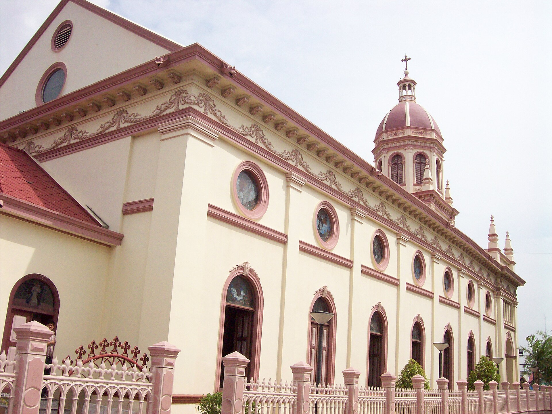
19
Talat Phlu railway-market rows
Philip Nalangan · Wikimedia Commons · CC BY 4.0
Market rowThonburi market settlement

Talat Phlu railway-market rows

ตึกแถวย่านตลาดพลู

A second old Bangkok, west of the river

A useful correction to palace-centred heritage: rail, canal, food trade and ordinary rowhouses made a second old Bangkok on the Thonburi side. The network matters more than a single trophy building.

Typology
Rail, road and canal market shophouses
Evidence
Curated corridor
Nearest public transport
Itsaraphap · 2139 m / Wat Arun Pier · 2945 m
Shapes to review
51 unverified candidates
Map geometry
OSM street axis · medium confidence

Explorer noteTrace one loop from railway to market to canal. Each infrastructure leaves a different rowhouse edge.
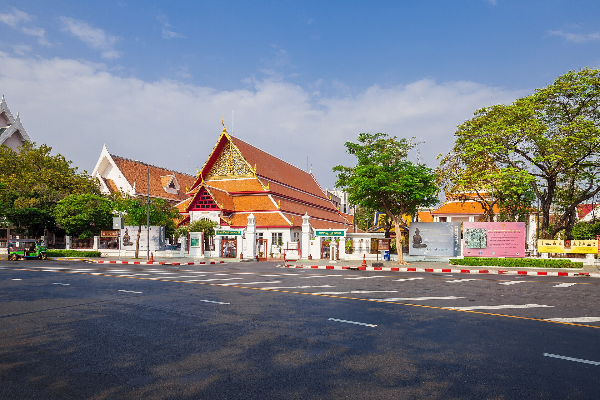
20
Tha Phrachan riverfront rows
This Photo was taken by Supanut Arunoprayote. Feel free to use any of my images, but please mention me as the author and may send me a message. (สามารถใช้ภาพได้อิสระ แต่กรุณาใส่เครดิตผู้ถ่ายและอาจส่งข้อความบอกกล่าวด้วย) Please do not upload an updated image here without consultation with the Author. The author would like to make corrections only at his own source. This ensures that the changes are preserved.Please if you think that any changes should be required, please inform the author.Otherwise you can upload a new image with a new name. Please use one of the templates derivative or extract. · Wikimedia Commons · CC BY 4.0
Royal frontageLate 19th–early 20th century

Tha Phrachan riverfront rows

ตึกแถวท่าพระจันทร์

A repaired frontage is not yet a conserved community

Between the palace-university wall and the river, books, amulets, food and ferry traffic compress into one inhabited edge. Conservation here has already shown its political question: repair the façade, but who gets to remain behind it?

Typology
University-and-pier shophouse frontage
Evidence
Published count
Nearest public transport
Tha Maharaj · 88 m / Tha Chang · 340 m
Shapes to review
150 unverified candidates
Map geometry
documented block extent · high confidence

Explorer noteWalk from the pier toward Thammasat at opening time; read the upper floors before the pavement becomes a market.

21
Asdang–Ban Mo rowhouse block
Chusak Vijakkhana - Chusak50 · Wikimedia Commons · CC BY-SA 3.0
Commercial streetRama V era onward

Asdang–Ban Mo rowhouse block

กลุ่มตึกแถวอัษฎางค์–พระพิทักษ์–บ้านหม้อ

108 units organised by streets, canal and backlanes

A published spatial survey counted 108 roadside units: 45 on Ban Mo, 16 on Phra Phitak and 47 on Asdang, with later rows inside the block. The canalside superblock shows Bangkok making a commercial quarter through incremental streets and backlanes—not a colonial masterplan.

Typology
Roadside and interior rows organised by canal, street and backlane
Evidence
Published count
Published count
108 units
ONEP survey
1E1-065 · 3E1-036
Nearest public transport
Sam Yot · 207 m / Sanam Chai · 417 m
Shapes to review
56 unverified candidates
Map geometry
documented block extent · medium confidence

Explorer noteUse Khlong Khu Mueang Doem as your compass, then loop Ban Mo, Phra Phitak and Asdang to read the three different street edges.

22
Srasong–Longtha rows
Chusak Vijakkhana - Chusak50 · Wikimedia Commons · CC BY-SA 3.0
Market rowBuilt 1910

Srasong–Longtha rows

ตึกแถวตรอกสระสรง–ลงท่า

Ninety-eight rentals built as one urban machine

Ninety-eight rental shophouses were laid out in 1910 between Wat Suthat and the Khlong Lod edge near Wat Ratchabophit. Parallel rows and service lanes make an urban machine from rent, water access and temple traffic—dense, practical and unmistakably Bangkok.

Typology
Privy Purse rental rows aligned with Khlong Lod and backlanes
Evidence
Published count
Published count
98 units
ONEP survey
2E1-075
Nearest public transport
Sam Yot · 265 m / Phan Fa Lilat · 862 m
Shapes to review
55 unverified candidates
Map geometry
documented block extent · medium confidence

Explorer noteEnter from the Wat Suthat side and leave toward Khlong Lod; the backlanes explain the block better than a single façade photograph.

23
Phraya Si–Si Kak rows
Chusak Vijakkhana - Chusak50 · Wikimedia Commons · CC BY-SA 3.0
Commercial streetEarly Charoen Krung road era onward

Phraya Si–Si Kak rows

ตึกแถวถนนพระยาศรี–สี่กั๊กพระยาศรี

A four-way hinge between royal city and port economy

At one of old Bangkok's great four-way junctions, the rows reveal how the first modern roads met an older Mon community and specialist trade. The result is not imported colonial order but a Bangkok hinge—royal city, port street and mercantile lane turning around one another.

Typology
Intersection rows linking Charoen Krung, Fueang Nakhon and Ban Mo
Evidence
Published count
ONEP survey
2E1-076 · 3E1-038
Nearest public transport
Sam Yot · 166 m / Sanam Chai · 591 m
Shapes to review
186 unverified candidates
Map geometry
OSM street axis · high confidence

Explorer noteStand at Si Kak Phraya Si and rotate slowly: each street carries a different period and trade, but the rowhouse scale holds the junction together.

24
Memorial Bridge bridgehead rows
Philip Nalangan · Wikimedia Commons · CC BY 4.0
Market rowEarly 20th century

Memorial Bridge bridgehead rows

ตึกแถวเชิงสะพานพระพุทธยอดฟ้า–จักรเพชร

The ordinary fabric that makes a bridgehead

The bridge is usually read as infrastructure and Pak Khlong Talat as spectacle. The surveyed rows between them are the missing urban tissue: small commercial bays absorbing flowers, ferries, road traffic and the daily transfer between Thonburi and the old capital.

Typology
Bridgehead and market-front rows on the Phra Nakhon bank
Evidence
Fine Arts register
ONEP survey
2E1-077 · 2E1-078
Nearest public transport
Yodpiman / Pak Khlong Talat · 260 m / Sanam Chai · 645 m
Shapes to review
1 unverified candidates
Map geometry
documented block extent · medium confidence

Explorer noteWalk from Pak Khlong Talat toward the bridge and look inland before crossing; the edge works as an exchange, not a monument forecourt.

25
Bang Rak multicultural rows
This Photo was taken by Supanut Arunoprayote. Feel free to use any of my images, but please mention me as the author and may send me a message. (สามารถใช้ภาพได้อิสระ แต่กรุณาใส่เครดิตผู้ถ่ายและอาจส่งข้อความบอกกล่าวด้วย) Please do not upload an updated image here without consultation with the Author. The author would like to make corrections only at his own source. This ensures that the changes are preserved.Please if you think that any changes should be required, please inform the author.Otherwise you can upload a new image with a new name. Please use one of the templates derivative or extract. · Wikimedia Commons · CC BY 4.0
Commercial street19th–20th century layers

Bang Rak multicultural rows

ตึกแถวพหุวัฒนธรรมบางรัก

Four cultural systems, one ordinary street

Bang Rak is the argument in miniature: Chinese shop signs, South Asian tailoring, western-company streets and Thai alleys occupy the same commercial spine. The heritage is not one approved style; it is difference that learned to share an address.

Typology
Chinese, South Asian, Western and Thai shophouse corridor
Evidence
Published count
ONEP survey
2E5-080
Nearest public transport
ICONSIAM Pier · 640 m / Saphan Taksin · 814 m
Shapes to review
130 unverified candidates
Map geometry
documented block extent · medium confidence

Explorer noteWalk Charoen Krung from Si Phraya toward Silom and count languages, upstairs access and shop-depth changes—not cafés.
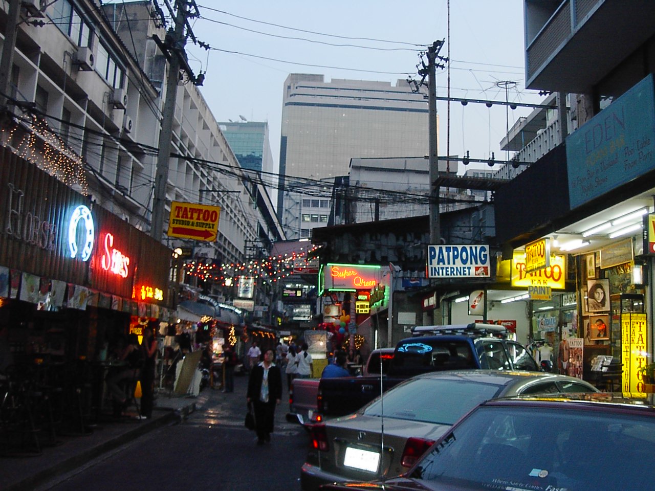
26
Patpong modern shophouse rows
Adam Carr · Wikimedia Commons · Public domain
Commercial street1950s onward

Patpong modern shophouse rows

ตึกแถวสมัยใหม่พัฒน์พงศ์

The postwar city is old enough to study

Heritage does not stop at 1932. Patpong's rows record Bangkok becoming a global service economy: daytime shutters, night businesses and separate stairs that turned upper floors into independent commercial territory.

Typology
Two-to-six-storey postwar commercial rows
Evidence
Published count
Nearest public transport
Surasak · 1529 m / Hua Lamphong · 1875 m
Shapes to review
23 unverified candidates
Map geometry
documented block extent · high confidence

Explorer noteVisit once by day and once after dark; the same row operates as two different pieces of city.

27
Field photo
needed
Canal market19th-century canal settlement

Nong Chok old market

ตลาดเก่าหนองจอก

Bangkok's old town reaches the rice fields

At the meeting of canals twelve, thirteen and Saen Saep, Chinese timber shops served a largely Muslim agricultural landscape. This is Bangkok too: not fringe, but the eastern half of the capital explaining how water, trade and coexistence built one another.

Typology
Timber shophouse rows along Khlong Saen Saep
Evidence
Published count
Nearest public transport
Pratunam · 37241 m / Hua Chang · 37844 m
Shapes to review
24 unverified candidates
Map geometry
curated connection · medium confidence

Explorer noteStand on the newer market side and look across the canal; the old commercial frontage makes sense from its former transport route.

28
Field photo
needed
Community conservationHistoric mixed-faith canal community

Charoen Krung 103 canal-market approach

ตึกแถวทางเข้าชุมชนเจริญกรุง 103

A rowhouse doorway into the canal city

The green-and-cream row is a threshold, not the destination. Pass through it and the arterial city gives way to a small weekend halal market, Buddhist–Muslim neighbourliness and a canal landscape hidden behind Charoen Krung.

Typology
Roadside rowhouses leading to a Muslim canal market
Evidence
Curated corridor
Nearest public transport
Asiatique · 416 m / Sathorn Pier · 2221 m
Shapes to review
56 unverified candidates
Map geometry
curated connection · medium confidence

Explorer noteThe canal market opens only on the first Saturday and Sunday of each month; the rowhouse approach is legible every day.

29
Dilok Chan lane
Philip Nalangan · Wikimedia Commons · CC BY 4.0
Community conservationHistoric Khlong San trading community

Dilok Chan lane

ตรอกดิลกจันทร์–ชุมชนสมเด็จย่า

The port survives as a lane

A tiny lane holds the afterimage of a larger port economy—salt sheds, fish-sauce works, export trade and the Guan Yu shrine. The important space is not a monument but the narrow public room made by rowhouses around collective memory.

Typology
River-trade lane enclosed by ordinary rowhouses
Evidence
Curated corridor
Nearest public transport
Yodpiman / Pak Khlong Talat · 507 m / Sanam Chai · 853 m
Shapes to review
8 unverified candidates
Map geometry
curated connection · medium confidence

Explorer noteEnter from Princess Mother Memorial Park and keep walking toward the Guan Yu shrine; the lane reveals its river logic gradually.